2025 Atlantic Hurricane Season Recap: Quiet in the U.S., Exceptionally Intense Elsewhere
A season that looked quiet—until it wasn’t
For much of the 2025 Atlantic hurricane season, the pattern suggested a year dominated by storms that never seriously threatened land. Many systems curved out to sea between Bermuda and the U.S. East Coast, reinforcing the familiar lesson that a season’s overall activity level does not always match its real-world consequences. By the time the season wrapped up, the totals stood at 13 named storms, five hurricanes, and four major hurricanes.
That headline count did not tell the full story. October ended with a dramatic shift in tone, and the saying “it only takes one” proved true again. The season ultimately became defined not by repeated U.S. landfalls, but by a smaller number of exceptionally powerful hurricanes and one catastrophic event in particular.
Hurricane Melissa: rapid growth and catastrophic impacts
The season’s most impactful storm was Hurricane Melissa. In the Caribbean, Melissa rapidly intensified into a Category 5 hurricane with 185 mph winds. Early messaging emphasized extreme rainfall potential—so much so that a forecast section was originally framed around the storm as a “Category 5 Rainmaker.” As the storm strengthened into an actual Category 5, wind became an extreme hazard on par with water.
Melissa blasted across western Jamaica with destructive force described as forest-ravaging and town-demolishing. The human toll was severe: more than 90 people were killed in Jamaica and Haiti. The damage was described in the billions of dollars, with recovery expected to take years.
- Melissa reached 185 mph as a Category 5 hurricane.
- It crossed western Jamaica at record strength for the country.
- More than 90 deaths were reported in Jamaica and Haiti.
- Damage was described as costing billions of dollars.
Melissa also set a national benchmark. It was the strongest hurricane to ever make landfall in Jamaica, exceeding the prior record by over 50 mph. The previous record-holder, Hurricane Gilbert (1988), made landfall at 130 mph and was described as relatively less impactful by comparison to Melissa’s landfall intensity.
After Jamaica, Melissa weakened from Category 5 status but still struck eastern Cuba as a Category 3 hurricane. Elsewhere in the region, the Bahamas, Haiti, and the Dominican Republic experienced days of relentless heavy rain.
Quality over quantity: three Category 5 hurricanes
While the number of tropical storms was slightly below average and many hurricanes recurved away from land, the hurricanes that formed were unusually intense. Of the five hurricanes, three reached Category 5 status: Erin, Humberto, and Melissa. This “quality over quantity” profile led some observers on social media to draw comparisons to the historic 2005 Atlantic hurricane season, not because of storm count, but because of how extreme some of the strongest systems became.
Erin: explosive intensification and a narrow escape
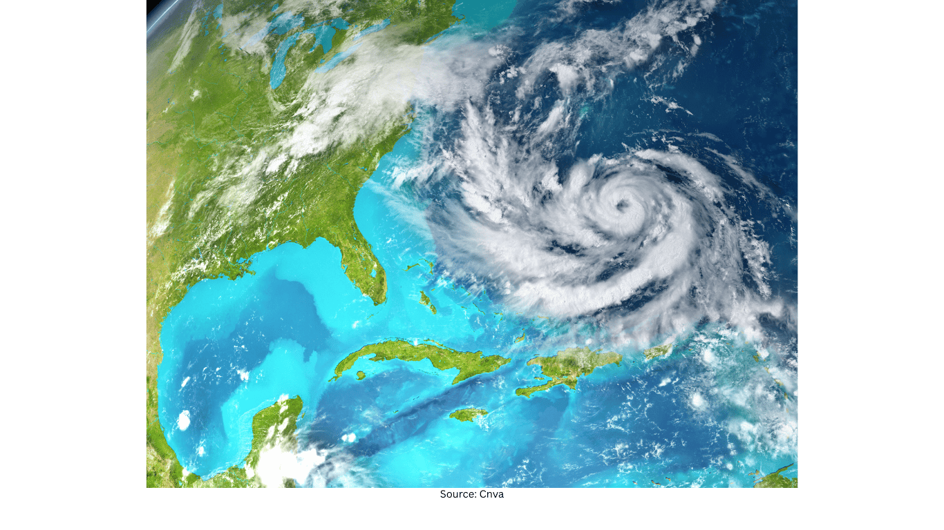
Hurricane Erin became a major storyline in mid-August. As it moved westward just to the northeast of Puerto Rico, it encountered progressively warmer water and favorable environmental conditions. Erin then underwent explosive rapid intensification—strengthening from a tropical storm to Category 5 in just under 30 hours. Even more striking, it went from Category 3 to Category 5 in just under six hours.
After reaching peak intensity, Erin expanded in size and narrowly threaded the gap between the U.S. East Coast and Bermuda, ultimately avoiding a more direct impact.
Humberto: fast strengthening, limited Atlantic impacts, and European havoc
The season’s second Category 5 hurricane, Humberto, rapidly intensified in late September. Winds jumped from 65 mph to 145 mph in 24 hours before the storm peaked at 160 mph. Like Erin, Humberto navigated a narrow corridor between the Bermuda High and the U.S. East Coast, and alongside Imelda it avoided a major U.S. landfall. Its direct impacts in the Atlantic were limited, with only some squally weather affecting Bermuda.
However, coastal effects were still felt. Several homes in Buxton, North Carolina, plunged into the ocean during rough surf attributed to the combined impacts of Erin, Humberto, and Imelda.
Humberto later became a significant storm in Europe, where it was called Storm Amy. Reports described widespread disruption from Ireland to Norway: hundreds of thousands lost power, rail and air travel were disrupted, and several people were killed. It was described as the second ex-hurricane to become a potent storm striking Europe, following Gabrielle.
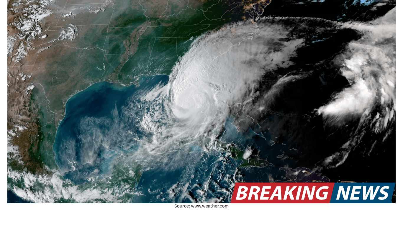
Imelda’s dramatic forecast shift—and a rare hurricane interaction
Late September brought one of the most unusual forecasting narratives of the season. What would become Imelda was at one point forecast to be near Charleston, South Carolina, as a hurricane, while Humberto was strengthening toward Category 5. Over just a couple of days, Imelda’s forecast cone of uncertainty executed a 90-degree right turn.
In a rare interaction, Humberto was described as pulling Imelda away from a U.S. landfall—an example of one hurricane influencing another’s track in a way that even experienced forecasters found notable. Meanwhile, Erin also went out to sea, further reducing the season’s U.S. hurricane risk.
U.S. impacts: no hurricane landfalls, only one tropical storm
Despite the intensity of several storms, there were no U.S. hurricane landfalls during the entire season. The last season without a single mainland U.S. hurricane landfall was 10 years earlier, in 2015. Only one storm made a mainland U.S. landfall in 2025: short-lived Tropical Storm Chantal in early July.
In the Gulf of Mexico, there was only one short-lived tropical storm: Tropical Storm Barry in June. Taken together, these details reinforced the season’s defining contrast—exceptional peak intensity in the basin, but limited direct hurricane landfalls in the United States.
Forecasting and models: AI gains attention, traditional guidance struggles
Beyond the storms themselves, 2025 stood out for how forecasting tools performed. AI was described as beginning to win against other computer models and even some human forecasts. Google’s DeepMind AI model drew attention for gaining forecaster support—quickly and within a single hurricane season—an achievement that hurricane-specific models have often taken several seasons to build.
According to a season modeling deep dive by hurricane specialist Michael Lowry, the model surpassed human forecasters for track forecasts in the Atlantic and Pacific and was competitive for intensity forecasts.
Meanwhile, the familiar contest between the American GFS model and the European ECMWF model was described as unusually lopsided. The GFS was characterized as very unreliable during the season and among the worst-performing models at every timestep. In practical terms, that unreliability influenced which guidance was shared and emphasized in day-to-day communication.
What 2025 emphasized
The 2025 Atlantic hurricane season delivered a clear reminder that seasonal risk is not measured only by the number of storms. With three Category 5 hurricanes—Erin, Humberto, and Melissa—rapid intensification events, and a late-season catastrophe in the Caribbean, the year became a case study in how a relatively quiet season for the U.S. can still be defined by extreme intensity and high-impact outcomes elsewhere.
Related Articles