
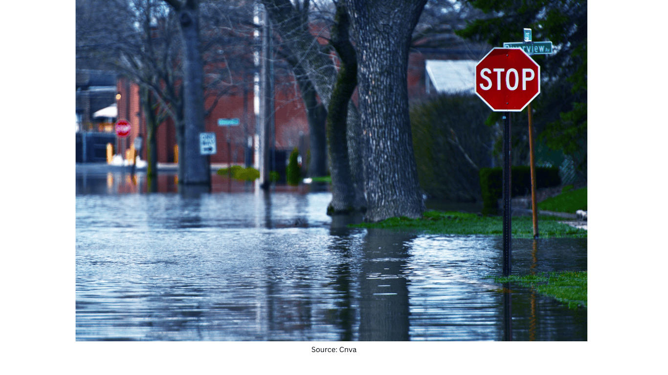
California Flood Threat Expected to Persist Into Early Next Week
A waterlogged California faces more unsettled weather
California’s wet stretch is not expected to end soon. An active weather pattern is continuing to influence the state, keeping flooding concerns in the forecast into early next week. With repeated rounds of precipitation, the overall message remains consistent: conditions stay unsettled, and the threat of flooding persists as additional rain moves back into the region.
While the details of each rain period can vary, the broader timeline is clearer. Rain is expected to return Friday, then continue on and off through the weekend. This kind of stop-and-start rainfall can still maintain a flood risk, particularly when the ground is already saturated and waterways are running high. Even when there are breaks between showers, the cumulative effect of multiple rounds can keep the situation elevated.
Rain returns Friday and continues through the weekend
The forecast calls for rain to move back in Friday. After that, precipitation is expected to continue intermittently through the weekend. In practical terms, this means some periods may be wetter than others, but the overall pattern remains active rather than clearing out quickly.
Because the state is already described as waterlogged, the renewed rain is significant. When rain falls on already-wet surfaces, runoff can increase more quickly than during a drier period. That is one reason flooding remains a concern through early next week, even if rainfall is not constant every hour of the day.
Flooding remains a key concern into early next week
The ongoing active pattern is expected to keep the threat for flooding in the forecast through early next week. This extended window matters for planning and awareness, since it suggests the risk does not end with the weekend. Instead, the overall setup continues to support additional precipitation and continued impacts.
In an extended wet pattern, flooding concerns can include a range of issues tied to repeated rain events. The forecast emphasis is on the continued threat rather than a single short-lived storm. As a result, the situation calls for continued attention to changing conditions as rain returns and then persists on and off.
Isolated tornado risk Saturday in parts of Northern and Central California
Along with the rain, there is also a low-end but notable severe weather consideration. The forecast notes that an isolated tornado cannot be ruled out on Saturday across Northern California and the Central Valley as the system approaches the West Coast.
This does not indicate widespread tornado activity, but it does highlight that the approaching system could bring enough atmospheric energy and wind conditions to support an isolated event. Because the wording is cautious—“can’t rule out”—the takeaway is preparedness and awareness rather than certainty. Still, it adds another layer to the weekend forecast beyond rainfall alone.
Snow levels drop, bringing a boost for mountain snowfall
While lower elevations deal with rain and flooding concerns, colder air is expected to lower snow levels over the weekend. That shift is important for the mountains, where several feet of snow are expected. For winter recreation and ski interests, this change is a bright spot within an otherwise stormy forecast.
Lower snow levels mean more of the precipitation in higher terrain falls as snow rather than rain. This can lead to significant accumulation in the mountains, especially when the pattern remains active and moisture continues to feed into the system. The forecast expectation of several feet underscores that the mountain impacts could be substantial.
What the overall pattern means for the weekend ahead
The forecast combines multiple elements—renewed rain, ongoing flooding concerns, a limited tornado risk, and heavy mountain snow—into one overarching theme: California remains under an active weather pattern. The timing emphasizes rain returning Friday and persisting on and off through the weekend, with flooding concerns continuing into early next week.
At the same time, the drop in snow levels and the expectation of several feet of snow point to a meaningful winter weather component in the higher elevations. This contrast is common in large storm systems affecting California, where lower elevations can see heavy rain while the mountains receive significant snowfall.
Key points to keep in mind
- California remains waterlogged, and the active pattern keeps flooding concerns in the forecast into early next week.
- Rain is expected to return Friday and continue on and off through the weekend.
- An isolated tornado cannot be ruled out Saturday across Northern California and the Central Valley as the system approaches the West Coast.
- Snow levels are expected to come down this weekend, with several feet of mountain snow expected.
Overall, the forecast points to continued unsettled conditions statewide, with the most persistent theme being the ongoing flood threat, alongside a notable winter weather boost in the mountains as snow levels fall.