
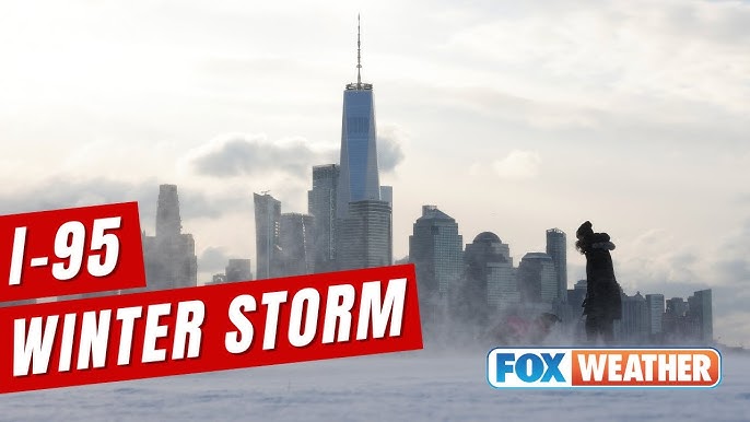
Could the I-95 Corridor See Snow Later This Week?
A late-week storm could bring more wintry weather
More snow is headed for the Northeast later this week as another system makes its way through the area. While the overall message is that a new round of wintry weather is possible, the details are still coming into focus. In particular, the question many people along the busy I-95 corridor are asking is whether this system will deliver accumulating snow to major cities or instead bring a mainly rainy event.
This kind of setup is familiar in the region: a low pressure system approaches, precipitation spreads in, and small changes in the storm’s position can lead to very different outcomes. For residents, commuters, and travelers, the difference between a “winter wonderland” and a “rainy mess” is not just aesthetic. It can affect road conditions, transit reliability, and day-to-day plans. At this stage, however, the forecast still includes meaningful uncertainty.
Why snowfall totals are uncertain right now
Snow totals are still uncertain as models disagree with their predictions. That disagreement is a central reason forecasters are cautious about pinpointing exact accumulation amounts, especially for locations near the rain-snow line. When different model solutions point to different storm tracks or thermal profiles, the range of possible outcomes widens.
In practical terms, this means that early snow maps or single-number totals should be treated as preliminary. The most important takeaway is not a specific number but the idea that multiple scenarios remain on the table. As the system gets closer and more observations feed into the forecasting process, the expectation is that guidance will converge and confidence will improve.
The storm track will decide what happens along I-95
The position and track of the low pressure system will determine if the I-95 corridor and cities like Boston will see a winter wonderland or be stuck with a rainy mess. Along the I-95 corridor, small shifts in the low’s path can change precipitation type. A track that favors colder air in place can support snow, while a track that draws in milder air can tilt the outcome toward rain or a mix that limits accumulation.
This is why the corridor can be so challenging to forecast in marginal situations. It sits near the dividing line where temperature profiles can vary over short distances. A city outcome can differ from nearby suburbs, and interior locations can see a different precipitation type entirely. In this case, the low pressure system’s exact placement will be the key factor that determines whether snow reaches the major coastal cities or stays primarily inland.
Interior Northeast: a wider range of potential snow totals
Snowfall totals in the interior Northeast could reach a foot of snow, but may also just see a few inches. That range underscores the uncertainty that still exists. Interior areas are often more likely to stay cold enough for snow, but even there, the final totals depend on the storm’s intensity, speed, and how long snow persists before any changeover or tapering.
A scenario that produces close to a foot would imply a longer-duration or more robust period of snow. A lower-end outcome of only a few inches would suggest either a quicker-moving system, less moisture, or a less favorable setup for sustained snowfall. Because the models are not yet aligned, both outcomes remain plausible within the current forecast envelope.
What the forecast questions mean for planning
With snow totals uncertain and the storm track still in question, the most sensible approach is to plan for variability. Along I-95, the main question is whether precipitation falls as snow or rain. For interior areas, the issue is less about “if” snow occurs and more about “how much” snow accumulates. Those are different planning problems, and they call for different levels of preparation.
For example, a primarily rainy outcome along the corridor could still be disruptive if it arrives during a busy commute or if temperatures fluctuate enough for slick spots in some locations. Conversely, a snowier solution could affect travel more broadly and require more time for clearing. In the interior Northeast, even a few inches can impact local roads, while higher totals closer to a foot can create more significant delays and require more extensive snow removal.
Key points to watch as the system approaches
Because the outcome hinges on the low pressure system’s position and track, updates closer to the event will be especially important. As the storm draws nearer, forecasters will be able to refine expectations for where the heaviest precipitation sets up and where the rain-snow line is most likely to fall. That refinement should also narrow the range of potential totals for the interior Northeast.
Until then, it helps to focus on the variables that are explicitly driving uncertainty in the forecast. The following are the main themes highlighted in the current outlook:
- Another system is moving into the Northeast later this week, bringing the potential for additional snow.
- Model disagreement remains, keeping snowfall totals uncertain for now.
- The low pressure track will be decisive, especially for the I-95 corridor and major cities such as Boston.
- Interior locations could see a wide range of totals, from a few inches up to around a foot.
Staying current as confidence improves
Watch for the latest forecasts and check back later as we get closer to the arrival of this system. In situations where models disagree, the forecast can change meaningfully as new data comes in. That does not necessarily mean the forecast is “wrong” early on; it reflects the reality that multiple outcomes are possible until the atmosphere provides clearer signals.
For people along the I-95 corridor, the next updates should clarify whether the event trends snowier or rainier. For those in the interior Northeast, updates should better define whether the higher-end totals remain on the table or whether the forecast leans toward more modest accumulation. Either way, the most reliable picture will come into focus closer to the storm’s arrival, when the low pressure system’s track is better resolved.
A forecast defined by the fine details
This late-week system is a reminder that winter forecasting in the Northeast often comes down to fine details. The region can experience sharp gradients in precipitation type and accumulation, and the I-95 corridor is frequently near the boundary between snow and rain. With another storm on the way, the potential exists for a wintry scene in some places and a wet, rainy outcome in others.
For now, the headline is simple: more snow is possible, but totals and impacts depend on the storm track, and the models have not yet settled on a single solution. As the system approaches, updated forecasts should provide clearer guidance on whether the corridor sees snow, whether Boston ends up with a “winter wonderland,” and how much snow the interior Northeast ultimately receives.