
Powerful Tornado Near Watertown, South Dakota, Brings Large Hail and Structural Damage
Overview of the event
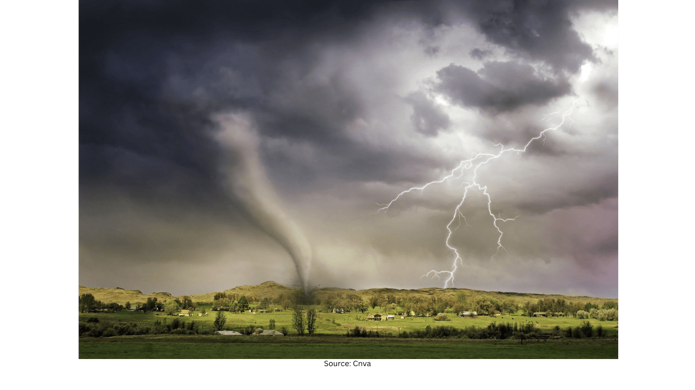
A powerful tornado struck near the town of Watertown, South Dakota, on Sunday, drawing attention as storm chasers documented the twister up close. Reports from the area said the storm also dropped hail described as being the size of baseballs. Along its path, the tornado left damage to structures, underscoring the destructive potential of severe weather when conditions come together.
Video documentation captured the storm’s intensity from close range, providing a clear look at the tornado as it moved through the landscape near Watertown. While such footage can help illustrate what a tornado looks like in real time, it also highlights the risks involved when severe storms are active in a community.
What was reported in the Watertown area
According to reports, the storm produced multiple hazards at once. The tornado itself was described as powerful, and it was accompanied by very large hail—reported as baseball-sized. Large hail can damage roofs, vehicles, windows, and outdoor equipment, and it can also create dangerous conditions for anyone caught outside.
In addition to the hail, the tornado left damage to structures in its path. Structural damage can range from minor impacts to significant destruction, depending on factors such as a building’s construction, the tornado’s strength at the moment it passes, and the debris carried by the wind.
How storm chasers documented the tornado
Storm chasers documented the twister as it moved near Watertown, capturing close-up views of the storm. Such documentation can provide valuable visual context for the public, showing the scale and motion of a tornado in a way that written descriptions cannot fully convey.
At the same time, close-range viewing of a tornado is inherently hazardous. Tornadoes can change direction, intensify quickly, and be accompanied by other threats such as hail and damaging winds. The footage from near Watertown serves as a reminder that severe storms can evolve rapidly and that safety should remain the priority when tornado conditions develop.
Multiple hazards in a single severe storm
The reports of baseball-sized hail alongside a powerful tornado reflect how severe thunderstorms can produce more than one dangerous impact. Hail of that size is capable of causing serious property damage, and when combined with a tornado, it adds another layer of risk for residents and anyone traveling through the area.
When a storm produces both a tornado and large hail, the danger is not limited to the tornado’s immediate path. Hail can fall over a broader area, and the storm environment can include strong winds and rapidly changing conditions. The Watertown-area storm illustrates how severe weather can affect communities in several ways at once.
Community impacts and damage considerations
The tornado left damage to structures in its path, which can have immediate consequences for residents and businesses. Even when damage is localized, it can disrupt daily life through impacts to buildings, vehicles, and outdoor infrastructure. The presence of large hail can compound these impacts, adding additional damage beyond what the tornado itself causes.
Because the storm was documented on video and described as powerful, it has also become a visible example of how quickly severe weather can escalate. For communities in tornado-prone regions, such events can reinforce the importance of preparedness and awareness during active storm periods.
Key details from the incident
- A powerful tornado struck near Watertown, South Dakota, on Sunday.
- Reports said the storm dropped hail described as baseball-sized.
- Storm chasers documented the tornado up close on video.
- The tornado left damage to structures along its path.
Why documented tornado events matter
Video documentation of tornadoes can play an important role in public understanding of severe weather. Seeing the storm’s movement and structure can help people recognize that tornadoes are not abstract threats; they are fast-developing, high-impact events that can affect real communities with little warning.
The Watertown-area tornado, as described and documented, combined a powerful twister with extremely large hail and resulted in structural damage. Together, these details paint a clear picture of a high-impact severe weather event—one that demonstrates both the intensity of the storm and the range of hazards that can accompany tornado-producing systems.