
Midwest Braces for Another Round of Severe Storms as Weekend Begins
A renewed severe weather threat for the Midwest
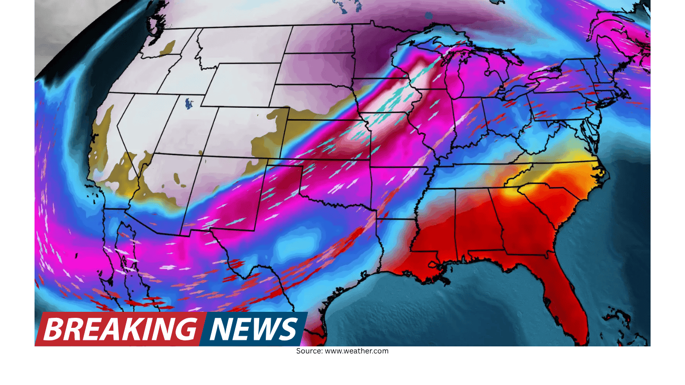
Severe weather is again in the forecast for the Midwest on Friday, a reminder that the region can see active storm patterns that repeat over multiple days. The latest setup places Iowa and Missouri in the bullseye for tornadoes, with the threat developing as the weekend begins. For residents, travelers, and anyone with outdoor plans, the timing matters: the ingredients are expected to come together on Friday, potentially setting the tone for the start of the weekend.
Forecast discussions around severe weather often focus on what is different from one day to the next. In this case, what stands out is the return of a familiar message: severe storms are once again possible, and the same general part of the Midwest is being highlighted. That does not mean every community will see the same impacts, but it does mean the broader environment is supportive enough that tornado potential is being emphasized for Iowa and Missouri.
Why Iowa and Missouri are being highlighted
When forecasters describe a “bullseye” for tornadoes, they are signaling that the overall setup is most favorable in a particular area compared with surrounding regions. For Friday’s forecast, Iowa and Missouri are the states singled out in that way. The implication is not that tornadoes are guaranteed, but that the probability of conditions supporting tornado development is higher there than elsewhere in the Midwest.
This type of geographic focus is important because it helps people prioritize preparedness. A severe weather forecast that covers a wide region can feel abstract, but a more targeted message—such as identifying Iowa and Missouri—provides a clearer cue for who should pay closest attention as the day approaches.
The “ingredients” coming together: what that means in plain language
The forecast discussion notes that the ingredients are coming together for Friday’s threat. In meteorology, that phrase is a shorthand way of saying multiple atmospheric factors are aligning in a way that can support severe thunderstorm development, including storms capable of producing tornadoes. While the forecast summary does not list each ingredient in detail, the key point is that the setup is not being driven by a single factor. Instead, it is the combination of conditions that raises concern.
For the public, the practical takeaway is that severe weather risk increases when several supportive elements overlap in time and place. That overlap is what forecasters watch for, and it is why the threat can become more pronounced even if the region has already experienced storms recently. A repeated severe forecast can be a sign that the larger pattern remains favorable for storm development.
Timing: Friday’s storms and the start of the weekend
The forecast emphasizes Friday and frames it as the beginning of the weekend. That framing is significant because many people make travel and event decisions around Friday afternoon and evening. A severe weather setup at that time can affect commutes, school activities, sporting events, and weekend departures.
Even within a single day, severe weather threats can fluctuate. The mention of ingredients “coming together” suggests that the forecast is focused on how conditions evolve into a more favorable state for severe storms. As a result, it is wise for people in the highlighted area to monitor updates through the day rather than relying on one early forecast snapshot.
What a tornado-focused forecast implies
Not all severe weather forecasts emphasize tornadoes. Some are more focused on damaging wind, large hail, or heavy rain. A forecast that places specific states “in the bullseye for tornadoes” indicates that tornado potential is a central concern for the day’s storm risk.
In practical terms, that can influence the kind of preparedness people should consider. Tornado threats require fast decision-making when warnings are issued. They also place a premium on knowing where to go if a warning is received—especially in the evening or overnight hours, when people may be less likely to notice changing conditions. While the forecast summary does not specify the time of day for peak risk, it does highlight Friday as the key period and underscores that the setup is supportive enough for tornadoes to be part of the messaging.
How meteorologists communicate risk in evolving situations
Forecasts for severe storms are inherently dynamic. Meteorologists often explain not just what could happen, but why the risk is increasing or decreasing. In this case, the forecast is accompanied by a breakdown from meteorologist Rob Shackelford, who describes the threat for Friday and explains why the ingredients are aligning.
This kind of explanation serves a purpose beyond simple prediction. It helps viewers understand the reasoning behind the forecast, which can make it easier to interpret updates. When people hear that the “ingredients are coming together,” they can recognize that the risk is being driven by a broader setup rather than a single isolated storm cell. That context can encourage more consistent attention to alerts and changing conditions.
What to do with this forecast if you live in the region
For people in Iowa and Missouri, the forecast is a signal to treat Friday as a day requiring heightened awareness. Severe weather does not strike every location in a highlighted region, but the potential for tornadoes means the consequences can be serious where storms do develop.
Because this is a forecast for the start of the weekend, it may also intersect with plans that place people outdoors or on the road. The best approach is to assume conditions could change quickly and to build flexibility into schedules where possible. Monitoring local updates and being ready to act if warnings are issued are common-sense steps during any tornado-focused setup.
- Keep an eye on forecast updates through Friday, especially if you are in Iowa or Missouri.
- Have a plan for where to go if a tornado warning is issued, particularly if you will be away from home.
- Consider how Friday timing could affect travel or outdoor events as the weekend begins.
- Take severe weather alerts seriously, since tornado potential is part of the forecast emphasis.
What to do with this forecast if you are traveling
Travelers often underestimate how quickly severe weather can disrupt a day, especially when storms develop along or near major routes. A Midwest severe weather setup on a Friday can affect weekend travel plans, whether by car or through delays that ripple across schedules.
If your route includes Iowa or Missouri, the forecast suggests paying closer attention to timing and potential changes. Even if a trip is still possible, it may be safer and less stressful to adjust departure times or plan for stops that allow you to avoid the most active period. Since the forecast highlights tornado risk, it is also important to think about where you would take shelter if you are not at home.
- Check weather conditions before leaving and again during the day, as the setup may evolve.
- If you will be driving, identify sturdy places you can stop if storms approach.
- Build extra time into your schedule in case you need to pause travel due to severe weather.
Understanding “again in the forecast”: why repeated threats happen
The phrase “again in the forecast” can be frustrating for communities that have already dealt with storms. But it also reflects how weather patterns can persist. When the broader environment remains supportive, multiple rounds of storms can occur over consecutive days or across successive weekends.
In forecast messaging, repeating the word “again” is a way of signaling continuity: the region is not simply experiencing a one-off event. Instead, the atmosphere is offering another opportunity for severe storms to develop. That is why meteorologists emphasize preparedness even after earlier storms have passed. The next round may not be identical, but it can still carry significant risk, especially when tornado potential is highlighted.
How to interpret a “bullseye” without overreacting
Being in a forecast bullseye can feel alarming, but it is best understood as a probability statement. It means the environment is most favorable in that area, not that every town will see a tornado. Severe weather forecasts are designed to identify where the risk is greatest so people can take reasonable precautions.
At the same time, tornadoes can occur outside the most highlighted zone. The bullseye is a tool for focusing attention, not a boundary line that guarantees safety elsewhere. People across the broader Midwest should remain weather-aware, while those in Iowa and Missouri should be especially attentive on Friday.
Bottom line for Friday
The Midwest faces another severe weather threat on Friday, with Iowa and Missouri specifically highlighted for tornado potential. The forecast points to ingredients coming together as the weekend begins, and a meteorologist’s breakdown underscores why the setup is being watched closely. For those in the region, the most practical response is to stay informed, keep plans flexible where possible, and be ready to take action if warnings are issued.
Severe weather forecasts are about managing uncertainty and preparing for high-impact possibilities. Friday’s message is clear: the risk is back, the focus is on Iowa and Missouri, and the start of the weekend could bring storms that warrant close attention.