
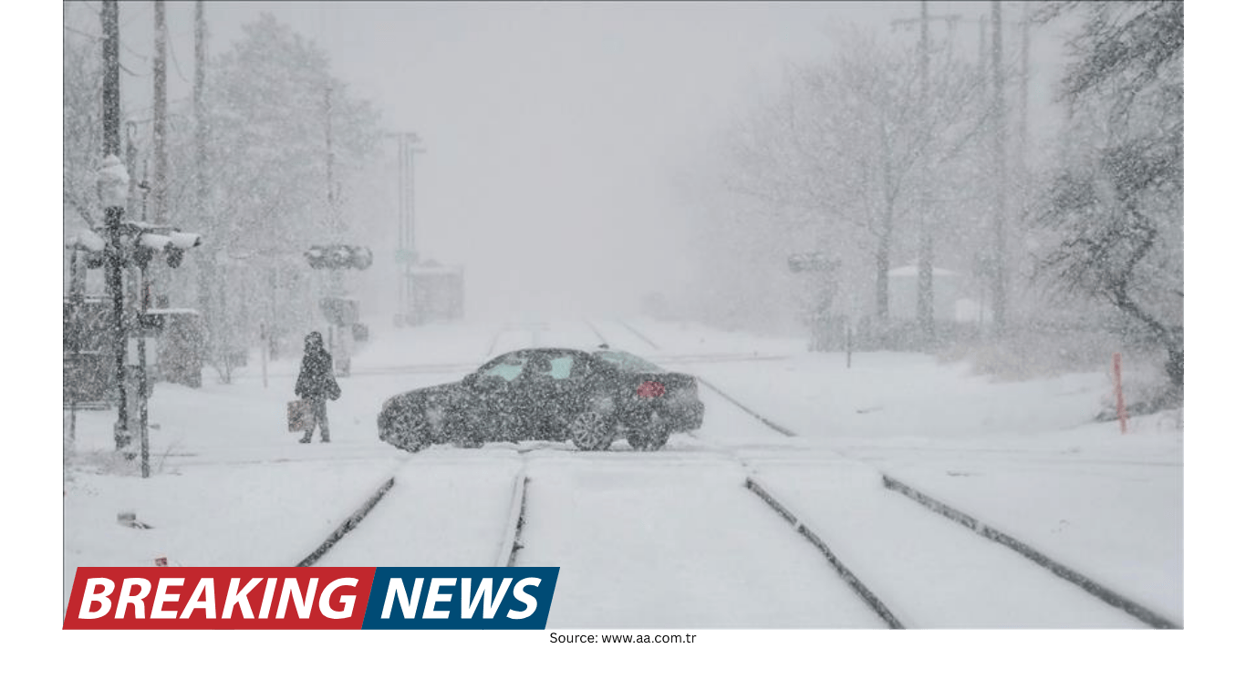
Winter Storm Could Affect the Mid-Atlantic and Northeast This Weekend
A warm stretch, then a reminder that winter isn’t over
After a period of relatively mild, comfortable conditions, attention is turning back to winter weather as a storm is expected to move toward the mid-Atlantic and Northeast this weekend. The shift is a familiar pattern for this time of year: a run of warmer days can create the impression that the season is easing, only for colder air and a storm system to reintroduce wintry conditions.
Forecasters say the setup bears watching, particularly because the storm is aimed at a heavily populated corridor where even minor changes in storm track or temperature can significantly alter what people experience on the ground. The overall message at this stage is caution and preparation rather than certainty. While a winter storm is expected, there is still uncertainty about the potential impacts—if any—across the Northeast.
That uncertainty is not unusual in winter forecasting, especially several days out. The difference between a cold rain, a mix of precipitation types, or accumulating snow can hinge on small variations in timing, storm intensity, and the boundary between warm and cold air. As a result, meteorologists are urging residents in the Northeast to monitor the situation closely for the latest information as the weekend approaches.
What is known so far about the weekend system
The current forecast discussion centers on a winter storm moving toward the mid-Atlantic and Northeast this weekend. The broad outline is clear enough to prompt early awareness: the system is expected to bring some form of wintry weather potential to parts of the region. However, the details—where the storm’s heaviest precipitation will fall, what type of precipitation will dominate, and whether impacts will be significant—remain less certain.
In practical terms, this means different communities may ultimately see very different outcomes, even if they are relatively close together. A storm track that shifts modestly could move the zone of greatest concern north or south. Likewise, a slight change in temperatures near the surface could determine whether precipitation falls mainly as snow, a wintry mix, or rain.
Because the forecast is still evolving, the emphasis is on staying informed rather than making firm assumptions. For people with weekend plans—travel, events, or errands—this is the stage when it’s wise to keep flexibility in mind and check for updated forecasts and advisories.
Why uncertainty matters in winter weather forecasts
Uncertainty in a winter storm forecast does not mean forecasters are unsure a storm exists; rather, it reflects the reality that the most important question for the public is often the hardest to answer early: what will it mean for my exact location?
Winter storms can produce sharp gradients in conditions. One area may see little more than wet roads, while another experiences slick travel and accumulating snowfall. These differences can occur over short distances, particularly in the mid-Atlantic and Northeast where coastal influences, elevation changes, and the position of cold air can all play major roles.
As the storm approaches, meteorologists typically gain access to more complete observational data and higher-confidence model guidance. That allows them to refine expectations about timing, intensity, and precipitation type. Until then, messaging often focuses on the potential for disruption and the need to monitor updates.
For residents, the key takeaway is that early forecasts are best used to raise awareness and prompt basic readiness steps, not to lock in precise expectations. It’s also why forecasters repeatedly encourage people to check the latest information: the most accurate forecast is usually the most recent one.
Regions to watch: mid-Atlantic and Northeast
The storm’s focus is on the mid-Atlantic and Northeast, a broad region that includes a wide range of climates and typical winter outcomes. In many cases, the mid-Atlantic can sit near the dividing line between rain and snow during marginal events, while the Northeast can see more consistent cold air—though that is not guaranteed for every storm.
At this stage, forecasters are not presenting a definitive map of impacts. Instead, the guidance is general: the system is expected to head toward these regions, and the Northeast in particular should monitor the situation to see the latest.
This approach reflects the current level of uncertainty. It also reflects the reality that impacts can vary not only by location, but by timing. A storm that arrives overnight can affect the morning commute, while a storm that peaks during daylight hours can disrupt weekend travel and activities. As updated forecasts clarify the storm’s schedule, the public will have a better sense of which time windows are most likely to be affected.
How to interpret “potential impacts, if any”
Forecast language that notes “potential impacts, if any” can sound cautious, but it serves an important purpose. It signals that while a storm is on the radar, the range of possible outcomes still includes scenarios where impacts are limited or localized.
In other words, the storm could still end up producing minimal disruption in some areas, even if other areas see more notable effects. This is especially common when the storm’s track is not yet locked in. A shift in the storm’s path could keep the most active weather offshore, or it could bring it closer to population centers.
For the public, this phrasing is a reminder to stay alert without overreacting. It encourages people to prepare for the possibility of winter weather while acknowledging that it is too early to say exactly what will happen everywhere.
What residents can do now: monitor, plan, and stay flexible
Even with uncertainty, there are practical steps people can take ahead of time that do not depend on a specific snowfall total or exact forecast track. The most important is simply to keep checking for updates as new information becomes available.
For those in the mid-Atlantic and Northeast, especially in the Northeast where monitoring has been emphasized, it may help to think in terms of contingencies. If the forecast trends toward more impactful conditions, having a plan can reduce last-minute stress.
Check updated forecasts regularly: Forecast confidence typically improves as the storm gets closer.
Review weekend plans: If you have travel or time-sensitive activities, consider how you would adjust if conditions deteriorate.
Allow extra time: If you must be on the road, flexibility can be valuable if weather timing shifts.
Stay aware of changing conditions: Winter storms can evolve quickly, and the latest update may differ from earlier expectations.
These steps are broadly useful regardless of whether the storm ultimately delivers heavy snow, a mixed event, or lighter precipitation. The goal is not to assume the worst, but to avoid being caught off guard if the forecast becomes more concerning.
The role of meteorologists and ongoing updates
As the weekend approaches, meteorologists will continue to refine the forecast, focusing on the storm’s evolution and what it means for specific communities. In this case, meteorologist Sara Tonks has provided the latest update, underscoring that the situation is still developing and that residents should keep an eye on the most current information.
Forecast updates in situations like this typically address several key questions:
Track: Where the storm is expected to travel relative to the coastline and inland areas.
Timing: When the storm’s most active period is likely to occur.
Precipitation type: Whether the event is more likely to produce snow, rain, or a mix.
Potential impacts: The likelihood of travel issues or other disruptions, and where those are most probable.
While the early headline is that a winter storm is headed for the region, the day-to-day value of forecasting lies in narrowing these details. That is why monitoring updates is repeatedly emphasized: the forecast is not static, and the most actionable guidance tends to arrive closer to the event.
Why this weekend’s storm is worth watching
Even in a winter season that includes ups and downs, a storm following a warm stretch can catch people’s attention. Mild weather can reduce the sense of urgency around winter readiness, and it can also influence how people plan their days—more travel, more outdoor activity, and less expectation of hazardous conditions.
When forecasters mention a “reminder that winter is still going strong,” it reflects both the seasonal reality and the practical need for awareness. Winter storms remain possible, and the transition from mild conditions to wintry weather can happen quickly.
The mid-Atlantic and Northeast are also regions where weather impacts can ripple widely due to population density and interconnected travel corridors. Even if the storm’s most significant effects are limited to a smaller area, the broader region often pays attention because of the potential for changing conditions and shifting forecasts.
What to watch for in the next forecast updates
As new updates arrive, the most useful information for residents will likely be clarity on where impacts are most likely and how confident forecasters are in that assessment. People following the forecast may want to pay attention to whether the outlook becomes more specific about:
Which parts of the Northeast are most at risk of seeing wintry conditions.
Whether the mid-Atlantic sits on a rain-snow line or trends more clearly toward one outcome.
How timing aligns with weekend travel and scheduled activities.
Whether confidence is increasing or decreasing in any particular scenario.
In many winter storms, the forecast conversation shifts from “there is uncertainty” to “here is the most likely scenario” as the event draws closer. That shift is often gradual, and it may include adjustments from one update to the next. For the public, the best approach is to treat the forecast as a living picture rather than a fixed promise.
Bottom line
A winter storm is expected to head toward the mid-Atlantic and Northeast this weekend, bringing the potential for wintry weather after a stretch of warmer conditions. Forecast uncertainty remains, particularly regarding the storm’s exact impacts across the Northeast. Residents are encouraged to monitor the latest updates as meteorologists refine the track, timing, and precipitation expectations in the days ahead.
For now, awareness and flexibility are the most practical tools: keep checking the forecast, consider backup plans for weekend activities, and be ready to adjust if the outlook becomes more impactful for your area.